From August 26th through September 8th a friend and I SOBO hiked 200 miles along a combination of the Sierra and South Sierra High Routes. With 40 miles left, we had to bail due to wildfires.
The Route
My path was actually a combination of two routes, the original Sierra High Route(SHR) and the South Sierra High Route(SSHR). The SHR runs about 195 miles, and the SHR runs about 100 miles along the spine of the Sierra Nevadas, through Yosemite and Kings Canyon National Parks, and multiple other Forests and wilderness areas.
From here on out I refer to the combined route at the S/SHR.
The route is predominantly off-trail, only sharing about 40 miles of trail with the JMT/PCT over its course, meaning navigating and route finding are essential and continual, and finding a firm and flat footing is a constant effort. It also has an extremely difficult average elevation gain/loss. I haven’t calculated the numbers but its probably between 700-900ft gross change per mile. Its extremely difficult, but as a result a hiker gets to see many of the high alpine views that are skirted by the PCT and JMT, which favor more moderate routes.
The original SHR was pioneered by Steve Roper in the 70s and 80s and he wrote the first edition of his guidebook in 1986. The routes southern terminus is in Cedar Grove Valley of Kings Canyon National Park and its northern terminus is at Twin Lakes near Bridgeport, CA.
The SSHR, as its name describes, picks up about where the SHR dives down to its southern Terminus in Cedar Grove. Instead the SSHR stays up in the high country, continuing to follow the spine of the Sierras all the way just beyond Mt. Whitney to Cottonwood Lakes.
The combination of the S/SHR offers the highest route to traverse the entire length of the core of the Sierra range.
*This map is not meant for any navigational purposes, it is missing many waypoints. If you want actual maps, see the resources at the bottom of this page.*
Gear
The Sierras are very dry and comfortably warm during the summer months. We expected a lot of sun, warm days, and cool but not cold nights. Since the elevation change per mile is so high, to spare my knees it was crucial to keep the pack as light as possible. Luckily, because of the weather, one doesn’t need much gear for a summer in the Sierras. My baseweight ended up around 7lb. But that is before the bear can, so actually its around 9lb.
Some specific considerations:
Bugs - Since we would be on trail late in the season, there were only a few straggling mosquitos left. We didn’t need much protection from them.
Rain - The Sierras average less than a half inch of rain during August. We needed to be prepared for a surprise shower but expected little rain.
Bears - Unfortunately there is no way around the bear can requirements through nearly all of the Sierras. While I believe their are perfectly effective ways to avoid encounters while not carrying a 2lb bucket, gotta follow the rules.
Trip Report
I’m currently working on a detailed report that will come out soon. Until then…
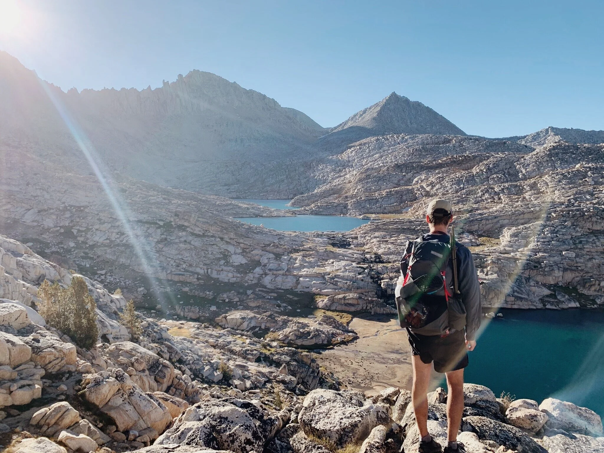
The S/SHR was epic. Certainly my hardest mile-for-mile hike to date, but also the most jaw-droppingly gorgeous. The SHR is one stunning view after another. The beauty is so ubiquitous it is almost numbing. The off-trail miles can be very rugged and very difficult, but boy are they worth it.
We made it 14 days and 200 miles and two resupplies before we were forced out of the mountains by sudden and rapid wildfire growth along the length of the Sierras. We had hiked from Twin Lakes/Horse Creek Pass and made our impromptu exit at Kearsarge Pass and the Onion Valley Trailhead. This left about 40 miles, including Mt. Whitney left uncompleted. So I’ll have to head back soon!
Q & A
Resources
If the SHR sounds like a route you’d like to check out yourself, here are some of the resources I’d recommend:
My Quick & Dirty Guide to the SHR
Sierra High Route: Traversing Timberline Country - The definitive guidebook written by the routes creator, Steve Roper. Because the route is so remote and at such elevation, I can’t recommend enough having a copy with you to help you navigate tricky or misleading navigational challenges you’ll face. Don’t carry the physical book unless you want the extra weight. Kindle app/download.
Andrew Skurka’s Resources: The legend himself has put together a dataset that contains printable maps and a list of waypoints for $15. He also has lots of great general recommendations on the route.
Adventure Alan’s South SHR Guide: The guide and maps of the SSHR all for free.